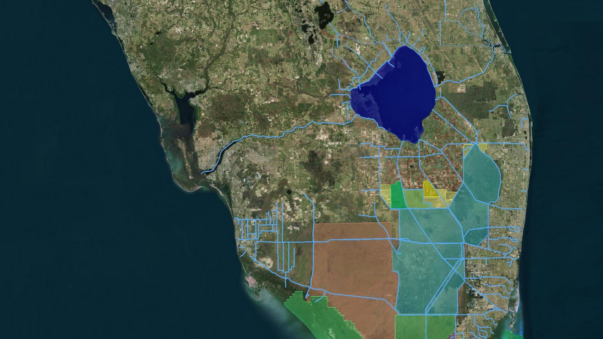
Lake Okeechobee and WCAs
Daily averages for 14 December 2025
Lake Okeechobee stage: 13.59 ft
Previous day: 13.60 ft
One week ago: 13.64 ft
(1965-2007 avg for today): 14.73 ft
Total Structure/Creek Inflows: 377 cfs
Total Structure Outflow: 842 cfs
Quick Reference for Map Flows
Lake Okeechobee stage: 13.59 ft
Previous day: 13.60 ft
One week ago: 13.64 ft
(1965-2007 avg for today): 14.73 ft
Total Structure/Creek Inflows: 377 cfs
Total Structure Outflow: 842 cfs
Quick Reference for Map Flows
3-Station: 16.64 ft |
||
S-11B HW: 13.68 ft |
||
Water Management Main Page
Status Update Archives WRDA Archives
Elevations are ft-NGVD.
Flows are average daily CFS...
Data is provisional and subject to revision.
Report generated: 14 DEC 2025 @ 18:55
Status Update Archives WRDA Archives
Elevations are ft-NGVD.
Flows are average daily CFS...
Data is provisional and subject to revision.
Report generated: 14 DEC 2025 @ 18:55
| *Updates are generally made on Fridays | |||
BCNP
ENP
Pump inflows: 0
Other inflows: 0
Other outflows: 0
Other inflows: 0
Other outflows: 0
Istokpoga: 0
S-78:
175
S-271: 148
S-352: 94
S-351: 120
S-354: 0
STAs to
WCA-1:
0
WCA-1:
0
S-155A: 0
STAs to
WCA-2A:
17
WCA-2A:
17
STAs to
WCA-3A:
0
WCA-3A:
0
S-10s: 0
S-11s: 0
S-12s: 244
S-39: 0
S-38: 31
S-34E: 0
S-31: 0
S-337: 0
S-190: 0
S-140: 12
S-151: 0
S-344: 0
S-343s: 0
S-333: 274
S-333N: 264
S-333N: 264
S-334: 0
S-356: 0
 ®
®U.S. Army Corps of Engineers